


Quality of Trails
Trekking between Val di Fassa and Pale di San Martino: 6–7 days
Trekking between Val di Fassa and Pale di San Martino: 6–7 days


Description
Why choose this trek?
-
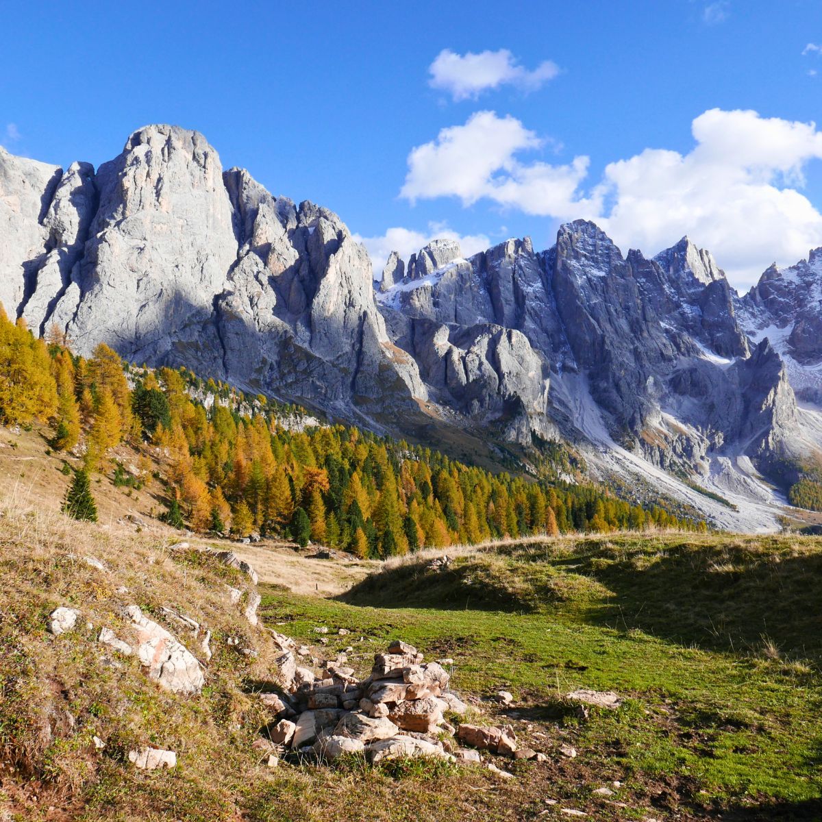
One of the most complete crossings of the Dolomites
The route connects very different Alpine environments: from the green valleys of Val di Fassa to the imposing Dolomite towers of the Pale di San Martino. -
Paths less frequented than the classic routes
Much of the itinerary follows little-traveled paths, far from the most touristic areas of the Dolomites. -
Extraordinarily varied landscapes
The trek crosses glacial valleys, rocky plateaus, alpine pastures, and panoramic ridges with uninterrupted views of the Marmolada, Lagorai, and Pale di San Martino. -
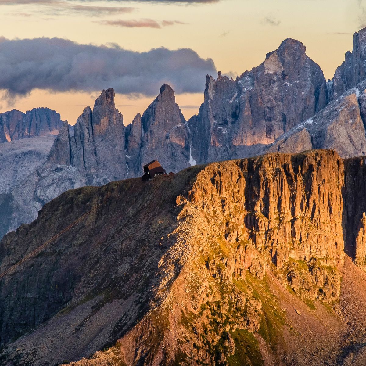
Authentic Alpine refuges
Nights are spent in mountain refuges and small Alpine hotels, ideal places to discover the hospitality and typical cuisine of the Dolomites. -
Alpine history and culture
Along the way you will come across numerous traces of the First World War , which transformed these mountains into a strategic Alpine front.
A trek through wild nature and alpine refuges
The itinerary mainly follows well-marked mountain paths , connecting some of the most evocative alpine refuges in the area.
Huts are a fundamental part of the experience: simple yet welcoming places where hikers and mountaineers meet after a day's walking. Here, you can savor traditional mountain cuisine, share travel stories, and experience the authentic atmosphere of the Dolomites. Sleeping in a hut also means fully immersing yourself in the rhythm of the mountains: silent dawns, clear starry skies, and the slow movement of clouds above the great Dolomite walls.
This dimension makes trekking not only a journey through the mountains, but also a cultural experience linked to the Alpine tradition of hospitality in refuges .
An itinerary away from the most crowded routes
Many of the most popular treks in the Dolomites pass through areas that are very popular during the summer. The crossing between Val di Fassa and Pale di San Martino , however, follows mostly less-traveled paths, allowing for a more authentic and peaceful experience. This makes the route particularly attractive for hikers seeking spectacular scenery without the large crowds of more famous treks .
The result is a journey where the silence of the mountains, the variety of landscapes, and the atmosphere of the refuges create one of the most complete trekking experiences in the Dolomites.
Who is this trek for?
Physical Requirements: Good general physical fitness. Previous specific mountaineering experience is not necessary, but is strongly recommended. It is essential to be comfortable with 5–6 hour walking days on variable terrain.
Refuge Accommodation: Nights are spent in some of the region's most comfortable refuges, with private rooms available for pre-booking. After hours of hiking through extraordinary landscapes, finding a warm bed, a shower, and a traditional multi-course dinner makes the experience complete and memorable.
Difficulty Level & Physical Requirements
Level 1 - Village-Based Hikes
Level 1 are our easiest hikes. You should be comfortable hiking 3 – 4 hours with up to 500 m cumulative ascent and a lightweight backpack of 2 – 3 kg. Families with small children can join Level 1 hikes.
Level 2 - Easy Hut-to-Hut Treks
You should be comfortable hiking 8 to 13 km per day with an average cumulative ascent of 500-600 meters and for approximately 5 hours on an average. Level 2 routes run only along well-maintained trails and primarily through easy terrain, such as meadows above the tree line.
Level 3 - Moderate Hut-to-Hut Treks
You should be comfortable hiking 10 to 15 km and for 5 to 7 hours (net hiking time, ie without long breaks) on well-maintained trails. Daily cumulative ascent on Level 3 itineraries is normally 600 to 1000 meters. Terrain on a typical Level 3 route varies significantly, but for most of the route you will be hiking through moderately difficult terrains. Exposed trails are not unusual on Level 3 routes, but they are widened or properly secured, normally with a metallic cord or chain, so that hikers pass without gear safely.
Level 4 - Challenging Hut-to-Hut Treks
Level 4 hut-to-hut hikes are designed for experienced and very fit hikers. To enjoy a Level 4 hike, you must be physically prepared for long crossings between huts with continuous and steep ascents of up to 1000 meters. Level 4 hikes may feature challenging terrain including loose talus, rugged trails, lightly maintained trails, insufficiently marked trails and sections of secured trail requiring use of via ferrata gear.
Season & Duration
Itinerary
Primary Itinerary
Prices
Travel
Stay & Meals
Main itinerary
What's Included
Getting to the Basecamp
Insurance and Visa
Accommodation
Meals


Trails
Difficulty
Accommodation
Solitude
Factors of Difficulty
Accommodation
Solitude


FAQ
Security Considerations
Insurance and Visa
Security Considerations
Clothing and Gear
Weather in the Dolomites
Insurance and Visa