

The first time you see the Dolomites, you'll probably stop mid-sentence. The valley opens. The towers appear — pale, vertical, utterly unlike anything in North America. And something in your chest decides it wants to be closer.
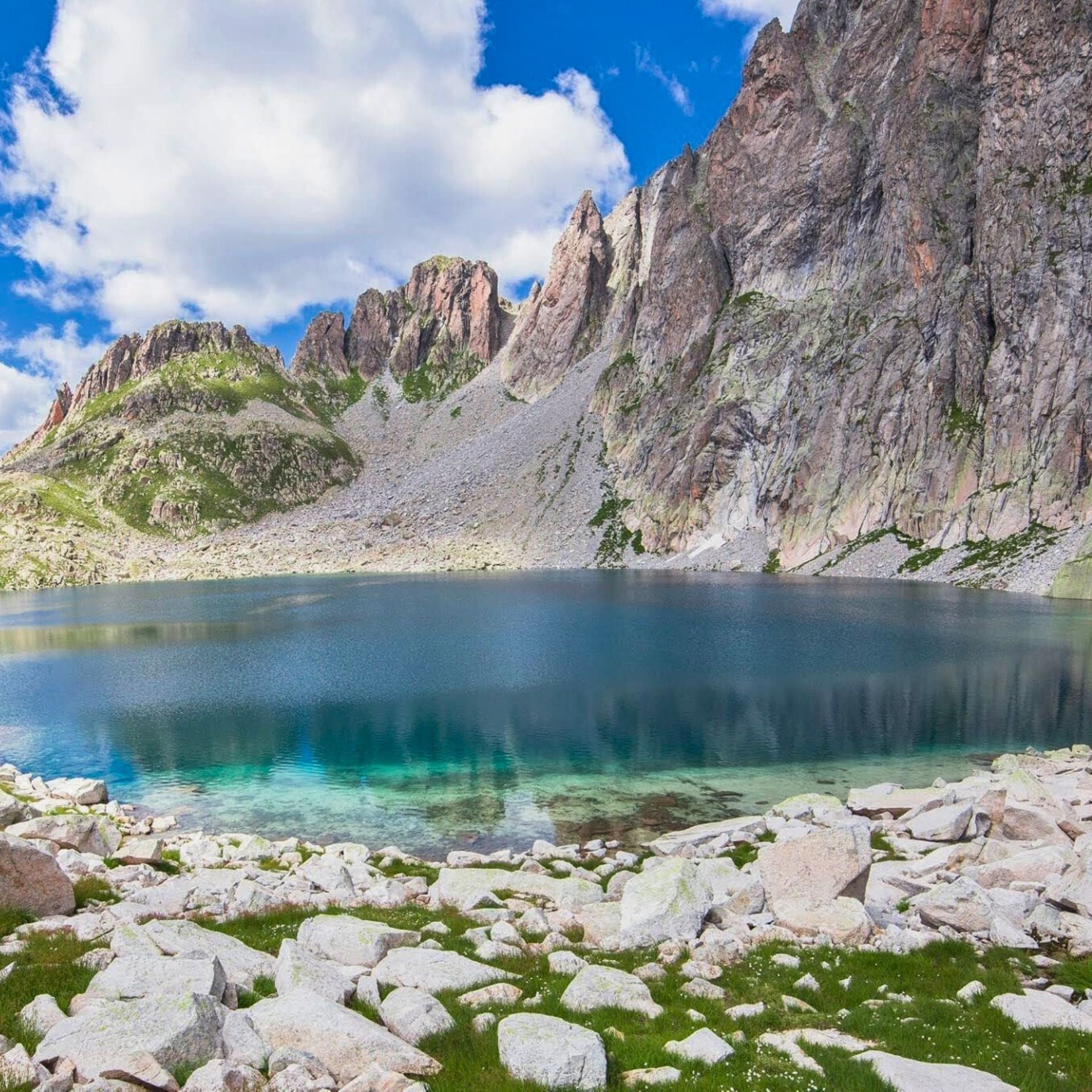
The Dolomites are a UNESCO World Heritage mountain range in northeastern Italy, spanning the provinces of South Tyrol, Trentino, and Belluno. Declared a World Heritage Site in 2009, the range encompasses nine distinct core zones across approximately 142,000 hectares. The mountains are formed of pale limestone and dolomite rock — an ancient coral reef pushed skyward by tectonic forces — and are famous for the natural light phenomenon known as Enrosadira: a fiery alpenglow that turns the peaks pink, orange, and violet at dawn and dusk.
This guide is for the American hiker who wants to do it right. Not just see it, but experience it at the pace it deserves.

The Puez-Odle Natural Park — one of the nine UNESCO core zones, and one of the finest hut-to-hut landscapes in the Alps.
In This Guide
What Are the Dolomites — And Why Do They Look Like That?
Most mountain ranges look like mountains. The Dolomites look like something assembled by a civilization that no longer exists. The peaks are vertical in a way that defies expectation — not rounded summits but sheer walls, spires, and towers of pale rock jutting from green meadows with no geological apology.
The reason is ancient. Two hundred and fifty million years ago, this region was a shallow tropical sea. Coral reefs built up layer by layer. Then, around 65 million years ago, the tectonic collision that formed the Alps pushed those ancient seabeds skyward — fast, by geological standards — creating the vertical walls you'll hike beneath today. Look carefully at the cliff faces: you can still find fossilized coral and sea creatures embedded in the rock.
The Enrosadira happens because the dolomite mineral composition — calcium-magnesium carbonate — reacts to low-angle sunlight at dawn and dusk, producing colors that move from gold through orange through deep violet. Plan your first morning in the mountains around sunrise. You won't regret it.
They span three Italian administrative regions, three languages (Italian, German, and Ladin — an ancient Romansh dialect spoken by the indigenous Ladin people), and enough trail miles to occupy a serious hiker for a lifetime.
The Five Best Hiking Areas in the Dolomites
The hardest part of planning a Dolomites trip is choosing where to go. The range is vast and internally diverse — each zone has its own character, its own difficulty profile, its own reason to be there. Here are the five that consistently deliver the most extraordinary hiking.
Puez-Odle Natural Park
Where the serious hikers go. The Puez-Odle plateau sits above Val Gardena and offers some of the most dramatic hut-to-hut terrain in the range — a high-altitude limestone karst landscape with rifugios perched at passes commanding 360-degree views. Quieter than Tre Cime despite being arguably more spectacular. Our Puez-Odle Hut-to-Hut Trek is built entirely in this landscape.

Pale di San Martino
The Pale — "the Pale Ones" — are a vast limestone plateau in the southeastern Dolomites that turn almost white in full sun and rose-gold at dusk. Less visited than the central zones, this area rewards the traveler willing to go further. The final leg of our Dolomites Crossing trek arrives here across a multi-day traverse from Val di Fassa — a journey with a real beginning, middle, and earned end.
Left: Alta Via del Granito through the wild Lagorai Range. Right: The MADE Trek crossing the Carnic Alps — 6–10 days of genuine remoteness.
Tre Cime di Lavaredo Zone
The most photographed corner of the Dolomites. Three near-vertical towers of pale limestone rise from a high alpine plateau at 9,843 feet, and the classic 9.3-mile loop circles them at close range. The photographs don't capture the scale — or the way the north face, all shadow and cold air, makes you feel appropriately small. Come in September when the crowds thin and the light turns golden.
Alta Badia and Val Gardena
The cultural heart of Ladin country. These valleys are where the indigenous Ladin people have lived for over 2,000 years, and where the food is noticeably distinct from the rest of Italy — hearty, Alpine, and deeply satisfying after a long mountain day. The rifugios here are among the best-stocked in the range.
The Friulian Dolomites
The great secret of the range. One of the nine UNESCO zones, yet receiving a fraction of the visitors that crowd the central areas. The centerpiece is the Campanile di Val Montanaia — a freestanding rock spire so improbable it seems designed rather than geological. Our Friulian Dolomites Wilderness Trek spends 7–10 days in this territory, in a Dolomites that most visitors never see.
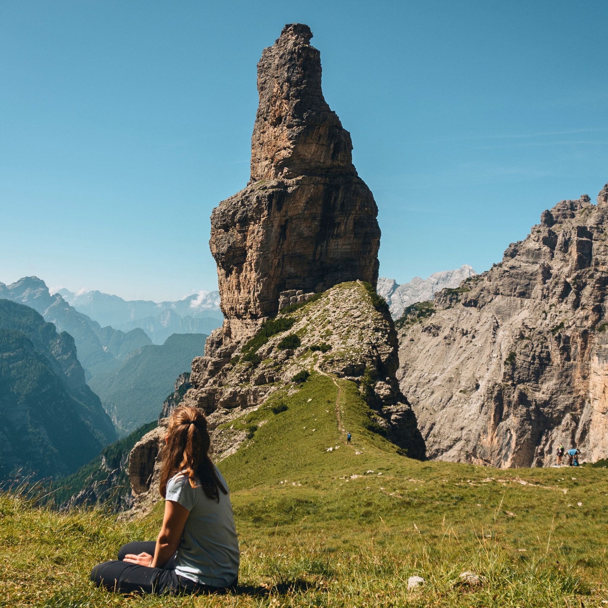
The Campanile di Val Montanaia in the Friulian Dolomites — one of the nine UNESCO zones, and the one almost nobody goes to.
When to Go: A Month-by-Month Reality Check
The hiking season runs from mid-June to mid-October. Everyone tells you summer. The truth is more interesting — choosing your window carefully can mean the difference between sharing a trail with 400 people and having a ridge entirely to yourself.
June
QuietMost high trails open mid-June as the last snow melts. Wildflowers — Alpine roses, gentians, edelweiss — are at their peak. Rifugios have just opened, trails are largely empty. Some high passes may still carry snow patches. Excellent for via ferrata and valley hikes.
July
BusyMountains fully accessible and spectacular. Busy at iconic spots. One weather pattern to plan around: afternoon thunderstorms build between 1–3pm daily. Start early, reach your ridgeline by noon, be inside or descending by early afternoon. A guide who knows local weather makes an enormous difference.
August
Peak SeasonWhen Europe goes on vacation. Parking lots fill before 8am at popular trailheads; rifugio beds require booking weeks in advance. The Friulian Dolomites and Lagorai Range remain genuinely uncrowded. Strategy required — the right guide knows where the crowds aren't.
September
Best MonthSummer crowds have left. Afternoon thunderstorms have mostly ended. Temperature is crisp and perfect for sustained effort. Light goes golden and stays golden. Larch trees begin their extraordinary autumn turn — lime to burning orange — mid-to-late September. Most rifugios still open until around September 20. This is the window Dolomist treks are built around.
October
Experienced OnlyMountains empty, colors peak, most rifugios closed. Requires self-sufficiency and preparation for shorter daylight and cold temperatures. Rewarding for experienced mountain travelers; not recommended for first-timers.
How Hard Is It? What American Hikers Need to Know
The Dolomites use the European Alpine trail rating system (T1–T6). Here's what that means in terms Americans already understand:
| Rating | What It Means | US Equivalent |
|---|---|---|
| T1 — Easy | Well-maintained paths, minimal elevation gain | National park visitor center loops |
| T2 — Easy-Moderate | Unpaved, some slope, clear markings | Smoky Mountains day hikes |
| T3 — Moderate | Mountain terrain, sustained elevation, occasional hands | Rocky Mountain NP, Angels Landing |
| T4 — Strenuous | Demanding paths, scrambling sections, some exposure | Enchantments (WA), JMT segments |
| T5 — Advanced | Via ferrata, technical terrain, significant exposure | Class 3–4 scrambling, exposed ridgelines |
| T6 — Expert | Alpine climbing territory, mandatory technical gear | Class 5 rock climbing |
Most Dolomist treks operate at T3–T4: genuinely demanding mountain hiking that rewards fitness and preparation, but requires no prior technical climbing experience. The Bocchette Via Ferrata in the Brenta Dolomites is T5 — an extraordinary experience for hikers ready to clip into a steel cable and traverse near-vertical rock with a harness and guide.
The Practical Fitness Benchmark
A good benchmark for a T3 Dolomites trek: you can comfortably hike 8–10 miles with 2,500 feet of elevation gain in a day, carrying a 20-pound pack, and recover well enough to repeat it the next morning. If you've completed multi-day hikes in the Rockies, Cascades, or White Mountains, you're likely ready. If your recent hiking has been mostly day hikes with under 1,000 feet of gain, give yourself 6–8 weeks of focused preparation.

The Bocchette Via Ferrata in the Brenta Dolomites — T5 terrain, guided, and one of the most memorable two days you'll spend in the mountains.
Guided vs. Self-Guided: Which Is Right for You?
Guided trekking in the Dolomites isn't about safety rails. It's about access.
A Dolomist guide is someone born in these valleys. They know which ridge offers a view no trail marker leads to. They know which rifugio kitchen makes the best Schlutzkrapfen, and which pass to clear before noon to avoid the afternoon storms. They carry the geological and cultural context that turns a very beautiful hike into something you'll still be describing ten years from now.
Self-guided trekking is a real option — and Dolomist offers it on the E5 route from Merano to Lake Garda — for hikers who genuinely value independence over guided depth. But for most first-time visitors to the Dolomites, a guide closes the gap between a good trip and the kind you talk about for the rest of your life.
→ Read the full comparison: Guided vs. Self-Guided in the Dolomites →
Which trek fits you?
First time in the Dolomites?
Two places to start.
5–7 days through classic UNESCO terrain. No prior hut experience required. This is where most Dolomist guests begin.
5–7 days of traverse trekking through UNESCO-protected landscape. A trip that earns its finish.
The Rifugio: Italy's Greatest Hiking Secret
There is no American equivalent of the rifugio, and this is one of the genuine cultural advantages the Dolomites hold over any mountain destination in North America.
A rifugio is a staffed mountain hut — built into the rock at altitude, stocked by helicopter or cable car, and serving food that would be considered exceptional at a restaurant at sea level. You finish a five-hour mountain crossing, drop your pack, sit down at a wooden table facing a panoramic window, and order a plate of hand-rolled pasta. The beer is cold. The strudel is made from scratch. The view is approximately 8,500 feet above the nearest supermarket.
On multi-day treks, the rifugio is where you sleep: typically dormitory-style rooms (private rooms exist but book early), clean linens, shared showers, and a communal dinner table atmosphere that turns strangers into hiking companions. The food is the tradition of the Alps: canederli (bread dumplings in broth), Schlutzkrapfen (spinach-ricotta pasta), kaiserschmarrn (a shredded pancake with jam that is somehow exactly what your body wants after 3,000 feet of climbing). A cuisine that exists nowhere else on earth.
→ The complete rifugio guide: what to eat, how to book, the best huts in the range →
Getting to the Dolomites from the US
There is no Dolomites airport. Most American travelers fly into Venice — direct flights from JFK, and one-stop connections from most US cities. The drive from Venice Marco Polo airport to the mountain areas takes about two hours, and the contrast between sea-level Italy and the Alpine world you're entering is part of the experience.
| Airport | Drive to Dolomites | Best For |
|---|---|---|
| Venice Marco Polo (VCE) | ~2 hours | Eastern Dolomites, Cortina, Tre Cime zone |
| Innsbruck (INN) | ~1.5 hours | Northern Dolomites, Val Gardena |
| Verona (VRN) | ~2 hours | Southern Dolomites, Val di Fassa, Pale di San Martino |
| Milan Malpensa (MXP) | ~4 hours | Only if combining with a Milan or Lake Como visit |
One critical logistics note: the Dolomites are large — driving from one major area to another can take 2–3 hours. Choose your base based on which trails you want to do, not just which town looks good in a search result.
→ Full logistics guide: airports, car rental, and transfers →

The E5 trail from Merano to Lake Garda — one of the great Alpine crossings, available as a self-guided Dolomist trek.
Frequently Asked Questions
Do you need hiking experience to trek the Dolomites?
For most Dolomist guided treks, yes — prior multi-day hiking experience and comfort with sustained elevation gain over consecutive days is recommended. No technical climbing experience is required for T3 trails. The Bocchette Via Ferrata requires additional technical instruction, provided by your guide.
Is it safe to hike the Dolomites alone?
Solo hiking is possible on well-marked trails. The risks — navigation in poor visibility, afternoon thunderstorms, injury at altitude — are managed significantly by trekking with an experienced guide who knows local weather patterns and terrain. Solo hiking on unmarked or technical terrain is not recommended for visitors unfamiliar with Alpine conditions.
How much does a guided Dolomites trek cost?
Dolomist guided treks begin from approximately €1,080 per person, covering the guide, rifugio accommodation, and most meals during the trek. Flights and pre/post-trek accommodation are separate. For a complete picture, write to the team — we'll match you to the right trek and provide full pricing within 24 hours.
What is the best Dolomites trek for beginners?
The Puez-Odle Hut-to-Hut Trek is the most popular entry point for first-time Dolomites trekkers. At T3 moderate difficulty, with 5–7 days through classic UNESCO terrain and rifugio nights included, it delivers the full experience without requiring prior hut-to-hut knowledge.
When should Americans book a Dolomites trek?
For summer and September treks — the peak and ideal windows — book at minimum 3–4 months in advance. Mountain hut capacity is genuinely limited, and popular departure dates fill early. 2026 dates are currently open.
What languages are spoken in the Dolomites?
The Dolomites straddle three language zones: Italian in the south and east, German in South Tyrol, and Ladin — an ancient Romansh language spoken by the indigenous Ladin people — in the central valleys. Most people in tourism speak basic English. A few words of Italian are appreciated; in South Tyrol, German is often more useful. Your Dolomist guide handles all of this seamlessly.
2026 Bookings Now Open
Mountain huts fill up fast.
Seven treks. One range.
Dolomist runs guided treks from June through October in the UNESCO Dolomites — small groups, local guides, rifugio nights, and an approach to these mountains that the people who built them would recognize: slow, respectful, and real.
Not sure which trek fits your fitness level, timeframe, or idea of a perfect mountain week? The team replies within 24 hours, with local expertise and no sales pressure.


